+71°
Wind
14 mph
Humidity
67 %
UV index
5 of 11
12:00 AM
+62°
08:00 AM
+59°
03:00 PM
+78°
Weather conditions
Wind
14 mph
Rain
1 mm
Temperature
+71°
Feels Like
+71°
Humidity
67 %
Pressure
1011 hPa
Cloudiness
100 %
UV Index
5
Sunrise
6:52 AM
Sunset
8:10 PM
Moonrise
6:09 AM
Moonset
7:37 PM
Precipitation Probability
100 %
Dew Point
+59°
Wind Gust
31 mph
Hourly Forecast
Air Quality Forecast
⚡Weather & Life
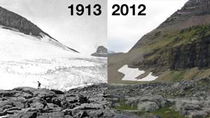
The Vanishing White: How Climate Change is Reshaping Mountain Snowpacks and Why It Matters
373 days ago
Red Yeast Rice Supplements: Natural Cholesterol Aid or Hidden Danger?
373 days ago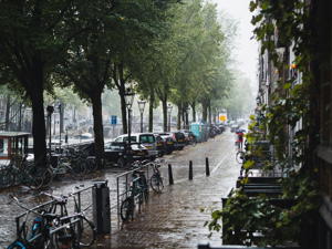
Transforming Gray Skies: Actionable Strategies for Productivity, Wellness, and Creativity on Rainy Days
372 days ago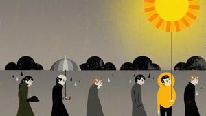
The Atmosphere Within: How Weather Influences Your Mood, Energy, and Well-being
371 days agoFrequently Asked Questions
Learn more about Weatheradar’s weather parameters, their units of measurement, and what values to pay attention to.
Atmospheric Parameters
Pressure refers to the atmospheric pressure at sea level, measured in hectopascals (hPa). Values higher than 1020 hPa often indicate clear skies, while values below 1000 hPa may signal storms or unsettled weather.
Humidity represents the percentage of water vapor in the air. Higher values (above 70%) indicate sticky or humid conditions, often preceding rain or fog.
Temperature Parameters
"Feels Like" accounts for wind chill or humidity, making it feel colder or warmer than the actual temperature. For example, wind can make a day feel colder, while high humidity makes it feel hotter.
The dew point is the temperature at which the air becomes saturated and water vapor condenses. Higher dew points (>20°) indicate humid conditions, while lower dew points (<10°) mean drier weather.
UV and Precipitation
The UV Index measures ultraviolet radiation from the sun. Values 0–2 are safe, while values 6+ require sun protection (sunscreen, shade).
Precipitation Probability is the chance of rain or snow. Values above 50% indicate a moderate likelihood, while values above 80% suggest you should carry an umbrella.